Tag Archives: Route 9

A Saturday ride to the Gotsu lighthouse

Another day, another ride… the day started with a quick visit to the Iwami Seaside Park to check out a friend’s new tent and tarp, and that was when I spotted the site for the day. For years I have camped here, and for years I have thought about visiting the Lighthouse on the other end of the beach. So Yuki and I saddled up and took a ride over.  

As you may know, riding gear is really not made for hiking, but the short hike up to the lighthouse was well worth it.  I am sure the view at sunset is amazing, but all the bear warning signs make me wonder if it is with it. 

Pointing to the spot where we usually camp, and where I am posting this from tonight. ;^) 

Iwami Loop

Yuki and I decided to take the bike down to Masuda on an errand, and we ended up doing a nice long Iwami Loop. We took route 9 down to Masuda to get a tennis racquet restrung, and when we learned it would take four hours the only option was to ride it out. We headed down through Hagi, and over the border into Yamaguchi to the Tamagawa campground. We drove down past the campsite to walk out to the beach, where we took the only two photos of the day.

After a couple of great burgers from Wild Kitchen at the Tamagawa rest stop, we headed further down route 191 to catch route 315 into the Yamaguchi mountains. This may be one of my new favorite roads. I will definitely be back. It has a nice balance of twists, turns, and beautiful mountain views. I think I need to go back to see it again in the fall…

From 315 we hopped on route 13 to swing through Tsuwano, which is a fantastic town to visit. However, today we just cruised straight through and hopped on route 9 back into Masuda, where we stopped in for a coffee at KuriKuri Coffee. Rather than return home up the coast on route 9, we decided to take another of my favorite roads, the Western Iwami Farm Road (A.K.A. 石見西部広域農道). This is a beautiful winding mountain road which is fairly new, and very lightly travelled. This is the nicest ride home from Masuda to Hamada, and it brings you right into Yasakamura, where you can visit friends before grabbing route 34 for the last thirty minutes back home.

Overall, it was a beautiful day for 200k. I am looking forward to a lot more beatiful two-up rides in the future. Next time I will remember to take more photos…

Hagi Moto-SUP Weekend 

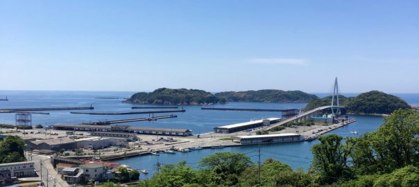
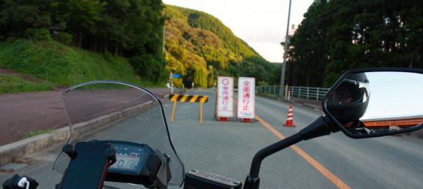
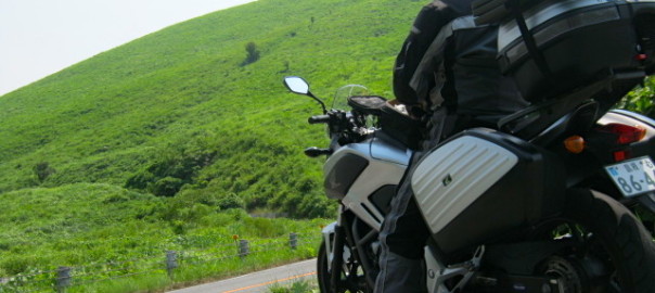
This past Friday I taught a class about an hour down the coast, and as it was a Friday I decided to make a camping trip of it. The class was in Masuda, which is the most south-western city in Shimane, so it was only an extra 20 minutes to the closest camp site over the Yamaguchi border. So Friday morning I headed out around 7:30 AM to head down to Masuda to teach my class. As always, the ride down route 9 was fantastic. While I may occasionally complain about traffic on that road, I must admit the ocean views along the way more than make up for it.

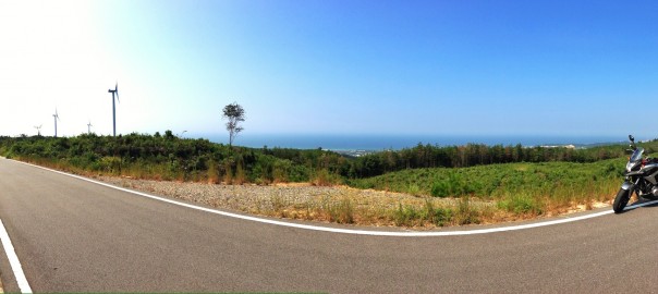
After teaching my class I took route 191 south, past the Hagi-Iwami airport, and along to the Tamagawa Campsite. I arrived to find a completely empty site. I took my time settling into camp; setting up the tent, tarp, hammock, and getting my lay of the land. The walk to the beach was only about 200 meters, and I found the perfect launch point for the SUP. However, it was getting late in the afternoon, so rather than inflating the board I decided to cook some dinner, drink a few beers, and head off for an onsen. Did I mention that the Tamagawa campsite has an onsen?

After falling asleep to the distant slapping of jumping fish in the river beside the campsite, I awoke around six AM to an empty campsite. It was still just me, the crows, mosquitoes, and occasional lost crabs. I took my time, relaxed, and cooked up some breakfast before inflating the SUP. The forecast promised for cloudy skies until 14:00, when the claim was that thunderstorms were forthcoming. As such, I decided to get on the water early, and hit the beach at around 9:30. The Tamagawa beach is a fishermen’s beach. It is only about 70 meters wide, and I put in between fishermen on both sides.  The beach was more stoney than sandy, but the water was flat and welcoming. Putting in was a pleasure, and the first shot straight out to a small islet/rock off the coast was a smooth paddle.

The plan was to keep things simple, as it has been a few months since I have paddled, so I set my sights on reaching the tip of the furthest visible outcrop of the coastal cliffs. This proved to be about three kilometers away. Along the way I found myself sidetracked twice; once by a an odd floating yellow seaweed island about three meters across, and then again by the appearance of a small jellyfish which I chased unsuccessfully.

Once I reached the furthest outcropping, I paused to look off at Shimane in the distance, gave the token nod/bow to the fishermen who had planted themselves there for the day, and then turn back for camp. On the way back I opted to hug the cliffs and enjoy the sights a bit. While I neglected to take photos of them, there were a lot of 亀の手 (A.K.A. Capitulum mitella) everywhere along the cliff walls at the waterline. Apparently they are a bit of a delicacy, so I guess I will be collecting some next time I am out paddling….

The great thing about hugging the cliff lines is that you come across all kinds of caves and little coves. I did find some great caves to explore, but I due to the tricky nature of navigating caves I did not get any photos. However, did get some shots of the coves and rock formations. One cove was especially interesting, as the wall was covered in greens which were apparently populated by frogs. The strong disconnect of paddling into a sea cove to the music of frog songs was a bit odd to me. I am accustomed to the keening of the birds, and the slapping of the waves, but frogs were a bit of a surprise.

After the frog cove, I found a larger cove with water like glass. The sea floor was completely covered with what looked like river stones. I paddled slowly and watched the small fish swim along seemingly oblivious, or indifferent, to my presence. It is these moments of gliding slowly over the crystal clear water, with a living world existing below you, that you can find an amazing sense of peace on the water.

As the forecast had promised thunderstorms in the afternoon, and I had no desire to be the tallest thing on the water at that time, I pulled back in around noontime. Eight kilometers was enough for my first water walk of the season in Japan, so it was time for a nice hot bowl of instant ramen, and then some hammock time.

Overall, I would definitely go back to the Tamagawa camp site. The onsen was fantastic, there is a rest stop and convenience store just 100 meters down the road, and the paddling is fantastic. The trip was actually a bit of recon, as I had previously identified this campsite at the perfect starting point for a Shimane West-to-East paddle. The coast is only about 300 km, so I figure if I break it into shorter paddles it can be done easily enough. As such, I can’t wait to head back to Tamagawa to do the first leg of the trip.

*Grammatical errors brought to you by Asahi Super Dry

A Therapeutic Commute

Sometimes it is really nice to commute to work. While my usual commute is a five-minute walk door-to-door, once a week I have to travel about 40 kilometers (about 26 miles) down the coast. One of the reasons I accepted this part-time post was that it would be a nice way to take the bike down the coast once a week. However, for the first few meetings of this class it has rained, so today was the first time I was able to make the commute on the bike. It was worth the wait.

Just about every five minutes I saw something that instantly made me regret not setting up a helmet or handlebar GoPro before leaving this morning. The recent rains brought out the greens along the side of the road and in the mountains, while also clearing  the air. The result was some fantastic ‘B&G Therapy’. (Blue skies and ocean, Green grass and mountains…)

The riding was so fantastic that I decided to take the long way home.

It took twice as long as the ride down the coast, but it was well worth it. If the weather is good again next week I will probably take the same route again. However, I will be sure to set up a GoPro and bring a camera along, as I truly regret not having pictures to share here.

The only image I took all day was actually at Yuhi park, which is just a few kilometers from the house. I have so many photos from there I hardly need another, but here it is anyway.

Biking to Boxing

It is nice when you can combine hobbies in a way that they are mutually beneficial. I love that joining the boxing gym gives me an excuse to ride the bike, and I love that having an excuse to ride the bike motivates me to go to boxing.

This is a winter ride, so the ‘greens’ are all brown, but the roads are the same shape all year. The ride there was fairly straight, as if followed the coast. Some nice beach views that way. The ride home, however, was rather twisty. I took the Green Line from Gotsu to Kanagi, which is a fantastic ride. Half way through I took a detour down the windmill maintenance roads, which are always fun.


Shimane Green Line

As today was the Autumnal Equinox, and a national holiday, I decided to take the bike out for a ride. I had just ridden the bike about 100 km back from the shop last night after having new tires installed, but they were all highway miles, and the shoes needed to get some gentle initial wear on the edges.  So I thought it would be a great chance to head out to the Shimane Green Line for a slow winding ride.

The Green Line is a nice meandering road through the mountains and of Shimane. I assume it gets its name from the virgin surroundings, as while the road is well built, and rather fun to ride, the areas it passes through are not very developed. It is a road that I have ridden many times, and greatly enjoyed. However, I think that I have only explored a bit of it as it seems to extend beyond where I usually join it.

The path I usually take is from the entrance to Mimata Onsen (A), where we used to live a few years back, through the mountains to route 9 in Gotsu (B).
View Larger Map

As I mentioned at the beginning of this post, I just had new shoes put on the bike, so today was all about taking it easy. It was a good thing too, as it seems that the clean up work  on the Green Line after the last few typhoons seems a bit behind schedule. While I was able to take some photos (below) of a number of the partially closed off sections of the road, there were a number of other hazards that I did not capture. The first actually caught me by surprise, and if I hadn’t been taking it easy on the new tires it may have spelled trouble. It was the largest landslide I encountered, and it was right around a tight, and blind, corner. It was a good reminder to take it easy, so I simply slowed down and appreciated the full greens of the surroundings while seeking out the signs of  autumn in the leaves.

About three quarters of the way through this section of the Shimane Green Line, alongside Mt. Koyasan, I came upon one of my favorite roads in Shimane. This particular road is barely over three kilometers in length, but I have certainly taken more photos here than anywhere else along the route. This is the maintenance road for the windmills overlooking Gotsu.

The views from up here, especially at sunset, can be rather stunning. I love to come up to this road and just ride slowly and take in the quiet and the views. As it is only a maintenance road, there is never anybody else there. It is the perfect spot to break out the camp stove and brew up a fresh cup of coffee. (I think I just gave myself a great idea!)

While I have traveled this section of the Shimane Green Line more times than I can recall, I also passed through another section in Asahi earlier today, and I think there must be more. I look forward to following the Asahi section back in the other direction to find out just how many other sections of the Shimane Green Line I can discover before the snows start to fall…

Hokkaido Report Via PlaceMe

PlaceMeWhen thinking back about past rides  we often focus on the roads taken and the destinations more than the stops. However, if you try out the iOS/Android app PlaceMe, it is easy to be reminded of all the forgotten places you stopped along the way.

Want to find that ramen shop you stopped at again? Did you forget the name of the campsite you stayed at, or the location of those awesome sunset photos you stopped to take? PlaceMe has you covered. It is a dead simple set-it-and-forget-it app. You simply set it to log any location you stop at for more than five minutes, direct it to send daily logs to your Evernote account, and that is it. At the end of each day you will get a summary of all the places you have been.

As an example, here are the maps for the twelve days of my Hokkaido trip earlier this month. (Click the first image to view them as a slideshow.)

You can see from these maps that my first day, riding from Hamada to Kanazawa, was a long ride with few stops. On the other hand, the ride from Otaru to Kutchan was overwhelmingly beautiful, and you can see that we stopped numerous times to appreciate the views. Using this data, I can fairly easily pinpoint the locations of all the photos I took with my DSLR, which does not have GPS data on its own.

The daily log that gets uploaded to your Evernote account actually includes details for each stop. If the app knows the location, it will create a link to the location’s Google+ page. If it does not know the location, it will give you the route number and city, which may (or may not) successfully link to a Google map. Take my final day as an example:

Here you can see that my first location is set at 9:59 p.m. on the 14th. That would be the apps best guess at where I was staying that night. It seems to have selected a restaurant near my hotel, but close enough… The next stop is a convenience store, Lawson’s, where I stopped to use an ATM and to drain the water from my boots. (See The Long Ride Home for the full report on this rainy ride.) The next stop was at 12:15, when I stopped to get some gas at Dr. Drive. As I had been riding for seven hours in the rain at this point, my next stop was 20 minutes later in a McDonalds to get some food and warm up a bit. Miraculously, the rain stopped while I was warming my hands around a cup of McDonalds’ infamously nuclear hot coffee, so the last stop before home was on route 9 in Gotsu, where I stopped at ゴリラ酒 (“Gorilla Alcohol”) to get some beer so I could warm up with a shower beer when I got home. (It seems there is a website for everything these days…) By the way, the route 9 link above is a perfect example of how this app fails for unknown locations outside of the USA.

shower beer

My data for the day ends in Gotsu, as I did not really move from home after enjoying my shower beer.

So now that I’ve shown you how I use this to track my stops when riding, how would you make use of this app?

Disclaimer: If you plan on cheating on your spouse, murdering someone, or just participating in some anarchy, you might want to turn this app off. The author will not be held responsible if  you accidentally place yourself at the scene of a crime.

The Long Ride Home

After spending a week and a half away from home, it was time to head back to Shimane. After our last day of riding in Hokkaido, cruising from Kushiro to Tomakomai,  we arrived at the Shin Nihonkai ferry terminal.  Just as we arrived the sky started to darken, and as we shuffled into the waiting area the rain started to bath the bikes as they lined up for boarding. The rain, while quite light, seemed to be a portent of bad weather that would follow me later on this last leg of the Hokkaido 2013 tour.

As luck would have it, I was the last bike, and therefore last vehicle on the ferry for this trip. We quickly parked our bikes in the allotted spaces and left them for the ferry workers to strap down while we sought out our bunks and a few beers for a farewell toast to Hokkaido. Gary and I sat and drank our beers as we watched the lights of the Tomakomai coast receded in the distance. We had done some great riding while up north, and these parting moments were spent reflecting on the roads we had ridden, the places we had visited, and the people we met. As we moved further out into the Japan Sea, and the cell coverage slowly faded away, we moved down to level three to retire to our bunks. Without a signal for my iPhone, I could no longer check in on the forecast for my ride home, so I gave up and caught some well deserved sleep. I awoke with the morning breakfast announcement and moved up to deck five to get some fresh air and catch up on some reading. There was not much else to do on the ferry unless you wanted to participate in the occasional bingo contest or watch a Japanese movie… So it was that I pushed most of the way through Tripwire; the third book in the Jack Reacher series.

As we approached the Tsuruga ferry port we were back on the phones checking routes and weather forecasts. Gary had an easy three-hour ride home to Kanazawa in fair weather, and I was looking at a 15 minute ride to a business hotel in Tsuruga. We didn’t speak much while we loaded the bike in preparation to ride ashore, as we both slowly came to grips with the end of the trip. We planned to meet up on the road somewhere before our paths diverged, but we ended up just waving and sharing an “お疲れ様” (“Cheers”) while we rode off our separate ways. I arrived at the hotel, checked in, and upon settling in immediately checked the forecast for the next day’s ride. The forecast was for rain. Rain starting at 4 a.m., and increasing in intensity throughout the day. So it was that I decided to get up as early as possible and get on the road. There was nothing to do about it, I was just going to have to do the 487 km ride in the rain.

I had the bike loaded and ready to go at 05:45, six minutes after sunrise, and the rain was already falling. So it was that I left Tsuruga in a light rain to start the ten hour ride home on national roads. It was about 45 minutes after I embarked that I realized that my new ‘waterproof’ over-gloves were not going to last the whole trip. While the material was certainly beading the rain, the water that was running down my sleeves was sliding right into the gloves, which lead to the creation of small lakes between my wrists and elbows. About thirty minutes later, after the rain started to pour down in sheets, I hit my first deep puddle. The resulting splash sent water directly up the inside of the legs of my waterproof pants and down into my boots. So now I had lakes in my sleeves, cold wet hands, squishy feet, and eight hours to go… As the rain let up to more of a sprinkle, I pulled over, drained my sleeves, and put away the waterproof over-gloves. Better to just ride with wet hands than deal with those forearm lakes. The boots would have to remain full for another hour before I pulled into a convenience store and attempted to drain them. No real improvement… Seven hours to go…

It was just around hour seven that the rain let up a bit and I pulled into McDonalds for my first meal of the day. I walked in dripping from head to toe and shook of the stares of all the other customers. I ordered a Big Mac meal with a coffee and sat down to warm up. I sat a good five minutes with the hot coffee cupped in my fishy hands. They were so white and swollen that it seemed I could simply scrape off a centimeter of skin without too much trouble. The hot coffee helped bring them back to life, and by the time I went back out to the bike I was almost feeling comfortable. The rain had completely stopped while I was eating, so I pulled out a spare pair of dry gloves and marveled at the seemingly wonderful sensation of dry leather against my skin. The Chugoku region, of which Shimane and Tottori are parts of, always takes care of me. It was in Tottori that the rain stopped, and the remaining three hours of riding were nearly a pleasure. Only the occasional squishing of water in my boots to remind me of the misery of the first seven hours. No matter how many times I come home from long rides, I always find myself marveling at the beauty of Shimane. Perhaps part of it is a bit of homesickness, but we do certainly have beautiful coastlines and the green backing of the Chugoku mountain range.

Overall, the Hokkaido trip was a fantastic experience. On both the first and final legs I dealt with heavy rains outside of Chugoku, but in Shimane the sun shone for me both times. She is good to me that way. All told, I put 3, 365 km on the bike on this trip, and I seem to have ridden my rear tire to the grave. The bike is essentially ‘up on blocks’ until the weekend, as I cannot ride on that tire. I guess she deserves a break, and so do I. A tow truck is coming Thursday to bring her into the shop for a new shoe and a check-up. In the meantime, Taiga and I will be planning a camping trip for next weekend. No rest for the wicked.

Roads Washed Out

Washed out ride map
Route Map. Click to enlarge for details.

We had quite a storm in Shimane a few days back, and there were a lot of landslides and flooding. We did not suffer any damage at our house, but the surrounding area is riddled with road closures and traffic due to road repairs. I have stayed off of the local roads for a few days, as I figured they would be rife with gravel & sand, and would not be safe for a motorcycle. However, the passing storm has brought about beautifully clear skies and pleasant weather, so today I gave in and risked the roads.

The Goal: Ride up route 9 to Aquas and purchase a souvenir/gift for a friend, then turn right into the mountains and find a roundabout way home.

The ride to Aquas was pretty straight forward, as there were no delays or road closings, but there were a number of landslides along the road that had already cleared up. The only hazard I faced along the way was a rather large book (yellow pages?) which was sitting in the right third of my lane on the bypass.

After picking up some stickers and crackers at the gift shop, I crossed the street from Aquas and took a photo with the iconic Aquas walking bridge (red pin on the map). The sky was beautiful, and a short ride down the road I found a spot on the beach where a couple of guys were enjoying some late afternoon wake boarding.

From Aquas I took the immediate right inland on the route 300 to Arifuku onsen. Unfortunately, I only made it about 500 meters before I met my first closed road. I turned back and continued up route 9 a bit further and tried again at route 299, only to find a second barrier to my return home. I was forced to backtrack and head back up route 9 again to route 297 towards Atoichi, and from their towards the Green Line into Kanagi. I was intentionally trying to avoid this road, as I love it and take it often and was hoping to find some new interesting paths through the mountains.

I was glad to see that I finally found a road that was open, but this path was rife with hazards. I only took photos of a few, but there were many collapse walls on the uphill side, and areas were the dowhill side of the road was washed out. It was a constant slalom of single lane traffic spots around blind corners, and it was a rather stressful ride.  The final photo below is of the eastern windmill access road, which is where I often go to take photos. Luckily the western access road was open and the sun was just starting to set.

I love riding these windmill access roads for a few reasons; the views are spectacular, the roads are new and well made, and there is never anybody else there. For these reasons, I find it a great place to ride and to take photos. This may be the first time I took photos on the western route, and I found myself glad that the eastern route was blocked.

Overall, it was a great day for a ride. Finding my way home past the closures and hazards was a fun challenge, and I think that I just may have captured a photo or two worth entering in the Hamada photo contest…